Part Four: 12-Part Ancient Mound Appreciation Guide

Briefly reviewing our journey before proceeding, Part Three of this Ancient Mound Appreciation Guide started at “New Smyrna Beach” where we documented an ancient coquina structure within an earthen mound. At “Seminole Rest” we studied mounds near the lagoon estuary that were built by Original Inhabitants, and yet, still standing as the foundation for colonist housing. At Emerald Mound we observed the similarities in design between the moon and sun “temple” mounds with larger pyramids at Teotihuacan. Traveling to Rock Eagle and Rock Hawk mounds offered an example of “effigy mounds” built with stones and maybe even a platform mound near the waterway. Historical evidence suggests that the mounds were likely built by the Guale or Yamasse Tribes. And at Teotihuacan, we witnessed ancient pyramids that were constructed with multiple tiers and also inner use areas.

PART FOUR

Monuments Featured: “Chattahoochee Mound Center”, Kolomoki Mounds, Ancient Mounds at Randall Research Center, L.S.U. Mounds and The Great Serpent Mound.

Chattahoochee River Mounds – Chattahoochee, Florida

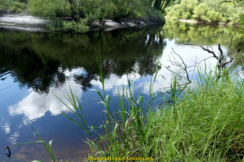
The so-labeled Chattahoochee Landing Mound Group earns significance as a major ceremonial center featuring a large pyramid shaped Temple Mound and two of six platform mounds forming a semi-circle that aligns strategically with important seasons of the sun. These ancient monuments were constructed by Mississippian Era people who possessed innate talent as engineers, designers and astrologers—the same builders of the Kolomoki Mounds at Blakely, Georgia. Archaeologists and historians delare that early Natives experienced hundreds of years (AD 900 - AD 1550) of natural abundance that facilitated viable sustenance, commerce and trade networks near the original confluence of the Chattahoochee and Flint Rivers. In 1799 it was recorded that Creeks named the river Chattahoochee (chat-to meaning "stone" and ho-che meaning "marked" or "flowered"). Nowadays this river system involves an impoundment on the Apalachicola River at "Lake Seminole" (a massive reservoir lake on the Georgia-Florida border) near its point of origin where the Chattahoochee and Flint Rivers meet. Some researchers claim this combination of the Apalachicola-Chattahoochee Rivers, totaling 430 miles, makes it the longest waterbody at Florida territory and moves the 310-mile Welaka River (St Johns) to second. Remarkable archaeological evidence reveals numerous human habitation and heritage sites along these ancient rivers, spanning from north Georgia Blue Ridge Mountains all the way to the Gulf via Apalachicola Bay at Florida.

Video Brief of Chattahoochee Mound Group


Kolomoki MoundsBlakely, Georgia

There is an impressive ancient monument called the "Great Temple Mound" that stands 57 feet tall with a flat-topped pyramid shape and circumference of 158 x 66 feet. It is the focal point of so-labeled Kolomoki Mounds Park which consists of several prehistoric mounds and evidence of a plaza, village or town, pole walls and artifacts. Some archaeologists claim the mounds were mostly built around AD 200-600 (or the "Middle Woodland Period") and the onsite historic marker notes it is "one of the largest and most important mound groups in the southeastern United States." The mounds are located in a remote area near "Blakely Georgia" surrounded by natural forested lands and two waterbodies, Lakes Yohola (impounded) and Kolomoki (formerly Little Kolomoki Creek and Chattahoochee River tributary). Research shows that the "Mississippian Period" lasted from about AD 800-1100 and developed "some of the most complex societies that ever existed at North America." Published records cite that the history of early Georgia is largely the history of the Creeks and disclose significant ancestral connections between the Muscogee-Creek and Guale-Yamasse groups well-established at Georgia, Florida, South Carolina, and other territories. Also, Kolomoki was said to be the name of a Creek Confederacy group called the Kolima-ki or Colima people, which infers lineage to the Indigenous Colimas of Mexico and Olmec-Mayan ancestry at South and Central America. The legacy of Original Inhabitants is worthy of continued scrutiny in pursuit of truths that dispel colonial dogma and exploitation.

Video Brief of Kolomoki Mounds


Calusa Heritage Mounds

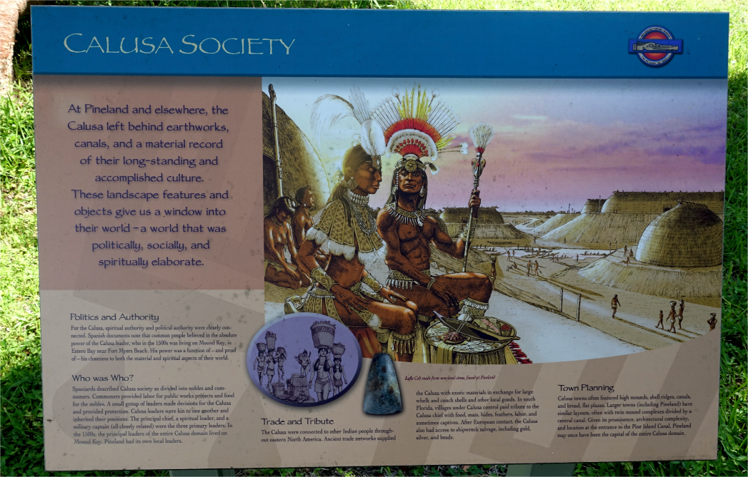
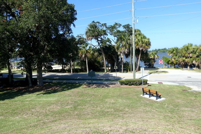
Overlooking Pine Island Sound are incredible monuments created by the ancient Calusa culture who ruled vast regions of south Florida. Possessing mound builder ancestry, they developed elaborate towns, designed important canal systems, and established complex political, social and artistic traditions. Pineland was a major shoreline Calusa town with significant mound formations that are being preserved as the Pineland Archaeological Site. More than 140,000 items were collected, including artifacts like ceramics, pottery sherds, tools, and decorative objects. This especial collection is said to contain 1900-year old uncharred seeds documented as "the only known prehistoric papaya seeds ever found in North America" and "the only prehistoric chile pepper seeds known for the eastern United States." In middle of the Pineland Site is the "Randell Research Center" which occupies 67 acres and conserves 100-plus acres of invaluable landscape and native estuarine terrain. The Calusa Heritage Trail passes through several mounds, including a sacred burial named "Smith Mound" (which formerly was 30 ft tall and 300 ft long and was surrounded by a lake) and the "Low Mound" (which stands 10 ft and 100 ft across and said to be older than the burial mound). Also, archaeological evidence shows that Mound Key, located on a high ridge above Estero Bay, was capital of the powerful Calusa kingdom and many ancient monuments are present there.

Video Brief of Calusa Heritage Mounds


Twin Mounds at Louisiana Campus

Two ancient monuments existing at the "Louisiana State University campus", powerfully, signify American Civilization prior to "colonist encroachment". These twin earthen mounds are reported to be, "the oldest known extant man-made structures in the Americas" built around 11,000 years ago. Researchers claim that prehistoric archaeological sites in the area were most notably of the Woodland and Mississippian cultures. These twin mounds are said to have been completed about 6,000 years ago and are similar in height—around 20 feet tall. Today, they overlook the Mississippi River floodplain. Archaeologists report finding fragments of charred mammal bone, suggesting the mounds had ceremonial or ritual purpose. It was also proclaimed that they were astronomically aligned with the giant red star "Arcturus" – which is among the brightest stars seen in the night sky from Earth.

The prominent mound duo were likely landmarks for travelers along the original Mississippi River (before it shifted). Interestingly, some historical documents note that First Inhabitants known as the Houma Nation were well-established along the east side of the River (now at "Louisiana" territory) prior to European invasion and usurpation. To avoid continual exploitation, the Houma kept moving southward (especially when energy companies discovered valuable oil and gas deposits on their homeland). Presently, they live in bayou communities, while consistently attempting to gain recognition that would restore their Indigenous rights.

Video Brief: “LSU” Mounds


“Serpent Mound - Peebles, Ohio”

The Great Serpent Mound, an enigmatic earthwork, is said to be the largest effigy mound in North America. Upon first sight, you might become overwhelmed with appreciation, awe, and wonder. And the incredible overhead panoramic views of the entire effigy is an even more spectacular experience. You embrace the stark realization that this is a large site containing three sacred Burial Mounds, built by Indigenous People on top of an elevated plateau about 150 feet above Brush Creek (a 60-mile tributary of the Ohio River and part of the Mississippi River watershed). The serpent effigy spans almost 1400 feet from its head (east, aligning to the Summer Solstice sunset) to its coiled tail (west, pointing to the Winter Solstice sunrise). And ancient cultures are thought to have utilized similar structures for timing agricultural planting and harvesting cycles. You get a sense of the snake's magnitude while walking the path around its body that showcases seven winding curves, which (reportedly) in 1846 measured 5ft high and 30ft wide and are now reduced to 4ft x 20 ft in certain spots. These curves likely have celestial significance that aligns with other star patterns. Upon reaching the platform overlooking the Brush Creek and Ohio Valley, indulge yourself with stunning vistas of nature's grace and majesty—flowing water, mixed forests, wildlife, and ancient bluff foundation, existing within varying environments from the past to present. What a blissful memory to cherish and share with others.

Our research of the area revealed geological history reports documenting that "Serpent Mound was built within the ancient remains of a meteorite impact crater." Interestingly, some archaeologists claim the builders of this mound effigy were the Ancient Adena Culture and/or Hopewell Culture; while others suggest the mound-building Fort Ancient Culture living in the Ohio Valley region were responsible, noting that similar rattlesnake designs were used by Mississippian cultures at Cahokia Mound. Some archaeologists determined that Adena and Fort Ancient cultures had roles in constructing the effigy since the burial mounds located nearby were from both of them (2-Adena; 1-Fort Ancient). After years of scrutinizing scientific data, archaeologists remain puzzled and acknowledge that Serpent Mound is extraordinary. We found that the esteemed legacy of Original Inhabitants is documented in areas all around the Ohio River Valley and beyond. Thus, we venerate the legacy of Ancient Mound Builders of the Great Serpent Mound and many others—fully aware that differences of opinion and speculation regarding its age, builders, culture, symbology (et cetera) is varied and vast.

Video Brief Serpent Mound Ohio


Part Three: 12-Part Ancient Mound Appreciation Guide

Let’s briefly recap our journey before proceeding. Part Two of this Ancient Mound Appreciation Guide started at American Beach, Florida (“NaNa Dune”). The high peaks of NaNa and Little NaNa dunes are formed by natural law. There is still a splendid similarity between this natural dune system and indigenous, constructed mounds. The People of the Land gather together beneath the proverbial shoulders of these massive structures to grow and heal in peace. Hallowed is the energy that sustains the natural beauty of such a place where Original Inhabitants find “relaxation without humiliation”.

(“Etowah Mounds”) We enjoyed surface level and high-bank views of the Etowah River along the journey from “Dahlonega Georgia” until reaching the ancient monuments at the Etowah Mound Center. And over the lengthy miles and many days we partook in as many museum tours as time and budgeting allowed. We panned for placer gold at Cherokee County, searched for minerals like pyrite near old mines, did a whole heap of window shopping at various “townships”, and secured memories to enrich a life time. It must be mentioned that meditation amongst these extraordinary mounds gifts generously.

(“Ocmulgee Mounds”) For those who enjoy brisk hikes in clean places, Ocmulgee Mounds will feel like home base. Or even if just kicking of your shoes and getting grounded sounds more refreshing—indulge! There is also an extensive museum on location so plan accordingly if interested; however, with mound sites, the true gifts are sun-kissed.

The Burial Mound at Ormond Beach rests just off the Kjipuktuk (Halifax) River. You can imagine how time might sail by at such a place where mourning doves softly call, cabbage palm flowers delight the senses and silvery mullet leap boldly from the water. We offer peace to the ancestors.

(Nocoroco-Tomoka River Mound) And one might ask, while gazing at the natural splendor along the Tomoka River, “Where is the mound?” You are standing on it! Representatives at the “Florida Department of Environmental Services” state that, “...the Tomoka Point is vulnerable to erosion from wave action and loss of plant cover by visitor use” and they have implemented erosion control measures. Tread gingerly upon these sacred grounds.

Ever Onward

PART THREE

Monuments Featured: “Mound and Coquina Structure New Smyrna”, “Seminole Rest Oak Hill”, Emerald Mounds Mississippi, Rock Eagle Mound Putnam County, “Teotihuacan-Pyramids near Mexico City”,

Mound and Coquina Structure – New Smyrna Beach, Florida

This ancient monument remains steadfast overlooking the west side of the Rio de Ais (“Indian River“), which evinces thousands of years of human existence along its natural shorelines. Reportedly, the Village of Caparaca was established by Indigenous Ais people living on the land prior to being labeled "New Smyrna" by European settlers. The coquina structure within the mound exhibits an intact foundation that has survived several unsuccessful attempts to add buildings on top of it. Presently, the mound and coquina structure are called the "Old Fort Park" Archaeological Site and surveying reveals the coquina ruins encompass about 3 acres; the large preshistoric mound is said to date to AD 700-1500; and nearly half of the mound was excavated. Also, many of the "official" reports offer varied opinions relative to construction of the foundations and most agree it is not a fort. In our opinion, though, it resembles many ancient coquina fortifications viewable at locations across the country and particularly, Mexico City.

Video brief - “New Smyrna” Coquina Structure - Mound


Mounds at “Seminole Rest - Oak Hill, Florida”

Several ancient mounds (reported to date from 2000 BC to 1565 AD) contribute to scenic views experienced along the waters of Mosquito Lagoon. Reportedly, they have significance as the only remaining intact mounds known to retain data about the "Orange-St Johns II" periods. Also, it is said that Timucuan and Ais peoples inhabited this part of Florida Territory and these magnificent monuments grace the terrain at "Seminole Rest" (an historic site which preserves these Indigenous mounds as well as the history of the structures built on top of them). The largest mound is said to be around 13 feet tall, measuring about 740 feet by 340 feet, and archaeologists speculate that it served as a distribution center for collecting and processing clams. Excavation recoveries at the site include projectile points, pottery sherds, and shell necklace beads.


“Emerald Mounds - Natchez, Mississippi”

One of America's largest ancient monuments was built by Mississippian Mound Builders (ancestors of the Natchez people) who established villages and flat-top mounds within the so-called Mississippi River Valley. Spanning eight acres, Emerald is an impressive rectangular platform mound (770 x 435 feet) said to stand about 35 feet tall; however, two secondary mounds on top increase its total height to around 60 feet. Some early observances claim there were six mounds on the north and south edge of the platform (3 on each side). Emerald Mound was significant as a ceremonial center for nearby villages and archaeologists have identified more than a dozen mound groups within 25 miles. It is said to be the third largest earthwork north of Mexico, following Monks Mound at Cahokia (Illinois) and Mound A at Poverty Point (Louisiana).


Rock Eagle Effigy Mound – Eatonton, Georgia

A stunning ancient monument, believed to have been built during the "Middle Woodland" period, is one of only two stone effigy mounds located east of the Mississippi River. An onsite historic sign states the Rock Eagle Mound Effigy rises 10 feet above the surrounding surface and is composed of white quartz rocks forming the shape of a bird in flight with head turned eastward (direction of the rising sun). Its wing span is 120 feet from tip to tip and measures 102 feet from head to tail. Some archaeologists speculate the mound was later inhabited by Mississippian, Muscogee-Creek and Cherokee cultures at Georgia territories, who continued to honor ancestral ceremonies and practices. Excavations and research found evidence of sacred human burials and a small amount of artifacts, necessitating reconstruction of this significant mound effigy. Thankfully the esteemed legacy of Original Inhabitants is preserved at its location near the Oconee River and Rock Eagle Mound is on the National Register of Historic Places.

Video Brief - Rock Eagle Mound

Images from a Journey of Appreciation to Rock Hawk Mound


Teotihuacan - Pyramids Near Mexico City

Numerous phenomenal landmarks exist on the vast terrains within the Americas, particularly Mexico City. Teotihuacan (an Aztec word meaning "the place where Gods were created") is a renowned architectural marvel that also showcases the ingenious planning by the ancient city's builders. What a memorable journey to appreciate the heritage and historical significance of the Pyramids of the Sun and the Moon, as well as the massive plaza featuring other structures like the Temple of Quetzalcoatl (a.k.a., the Plumed Serpent). Also, we watched as locals celebrated in the street during a major religious festival and pridefully presented their native artistry (pottery, clothing, tasty cuisine, et al) at outdoor markets and other venues. We enjoyed pleasant outings surrounded by people who graciously found ways to interpret our sometimes limited Moorish Latin vocabulary.

In addition to abundant visual observances of ancient buildings and sites throughout the region, the National Institute of Anthropology and History offers a plethora of documentation and exhibits that acknowledge the Cultura Madre's (meaning the Mother Culture’s) importance to humanity. It is said that Teotihuacan is one of the archaeological sites with the longest history of exploration in Mexico. Reportedly, the Pyramid of the Sun was "reconstituted" to add a “fifth tier” and, since 1962, stringent guidelines have been implemented for excavation of incredible discoveries contained within the cave (Palacio de Quetzalmariposa) located under the Pyramid of the Sun.

Video Brief of journey to Teotihuacan Pyramids


Part Two: 12-Part Ancient Mound Appreciation Guide

During Part One of this Ancient Mound Appreciation Guide, we reviewed journeys to five honored locations where Original Inhabitants have gathered since time immemorial.

At North Carolina (“Town Creek Mound”) we shared highlights from our second journey to the Little River area and continued until reaching the Pee Dee further away. We paused to investigate native grasses and sedges and aquatic plants thriving along riverbanks. We observed stands of evergreen trees in route and the clear crown-spreads of various deciduous trees. And as customary we stopped to reflect on the great integrity of our people. During our travel throughout the local area we paid special attention towards Asiatic business, historical markers and artwork. In reflection, I wonder if the Most Noble of Brothers, Drew Ali, found solace along these sacred ley-lines. Peace

At West Virginia (“Grave Creek Mound”) we were awestruck by the presence of the astonishing conical mound, patiently hiking up to its precipice and enjoying elevated views of the community and waterway. We were so enthralled we had to extend our journey to allow more study time of the various exhibits at the museum on location. We were able to learn more about petroglyphs uncovered nearby and also Mount Carbon.

Along the Santee River at South Carolina (“Santee Mound”) we experienced peaceful introspection and solitude as the mound site was sparsely occupied. We had plenty of time to study native trees and plants (wisteria was in bloom with its delicious natural fragrance). Various families of birds were either perched on high limbs or riding thermals.

During travels near King Mounds at Kentucky (“Wycliff Mound”) we observed the platform mounds and plaza on the higher banks and the confluence of the Mississippi and Ohio Rivers and later the community of Cairo.

And at “Saint Marys West Virginia” (“Reynolds Farm Mound”) we circled the ancient mound called “Reynolds Farm Mound” at a small community situated along the Ohio River. We are thankful for its considerate preservation.

Let’s Continue!

PART TWO

Monuments Featured: “NaNa Dune”, “Etowah Mounds”, “Ocmulgee Mounds”, “Ormond Burial Mound”, “Nocoroco Tomoka River Mound”

NaNa Dune, American Beach

This ancient natural monument is said to be the largest sand dune (60 feet tall) at Florida territory and serves as protection from storm damage to shoreline resources. The dune was penned "NaNa" by environmental advocate MaVynne Betsch (affectionately called "The Beach Lady"). Through years of diligence, she helped to preserve the sacred dune, its essential flora and fauna habitat, and its nearby shoreline community—American Beach, which flourished into an historic "African-American" beach town first called Franklin Town. Today, NaNa Dune, situated on 8.5-acres within American Beach and located on the south end of Amelia Island, is protected by the National Park Service as part of the Timucuan Ecologic & Historic Preserve. Also, in 2021, the North Florida Land Trust acquired 1.5-acres nearby known as "Little NaNa" and their description notes that it has importance in helping protect a portion of this increasingly rare intact "ancient" dune system.

Video Brief of the NaNa Dune System at American Beach


Etowah Mounds, 813 Indian Mounds Road NE, Cartersville, Georgia

Etowah Mounds are said to be the most intact Mississippian Culture site in the Southeast, encompassing 54 acres with numerous mounds, a village and plaza, borrow pits, and defensive ditch situated along the Etowah River. Reportedly, the primary temple mound stands around 67 feet and is said to be the tallest Indigenous mound at Georgia territory. As ancient mound builders, and based on archaeological evidence, these Original Inhabitants are thought to be ancesters of Muscogee (Creek) and Cherokee people; also, the words "Etowah" or "Italwah" or "Itaba" mean 'town or trail crossing' in the Muscogee language. With only a small percentage of site evaluated, researchers acknowledge significant artifact recoveries such as a pair of carved marble effigy statues and treasured Indigenous nobility burial items.

Video Brief-Etowah-Mounds


Ocmulgee Mounds - 1207 Emery Highway - Macon, Georgia

The spectacular ancient monuments, known as Ocmulgee Mounds, are situated along the Ocmulgee River, where Original Inhabitants existed for thousands of years. As part of the so-named Macon Plateau (region of the largest archaeology dig in American history, recovering 2.5 million artifacts), these precious landmarks built by esteemed Mississippians (Mound Builders) sustained much damage during the excavations. Restorative efforts included preservation of eight mounds and village areas, creating historical signage, and adding space to display some of the 2,000+ artifacts removed. The Muscogee (Creek) people were exceptional farmers—they lived in this vast river valley, established a large central village surrounded by numerous small towns, and eventually became known as the Muscogee Confederacy or Nation.

Video Brief _ Ocmulgee Mounds


Burial Mound Ormond - Ormond Beach, Florida

This sacred Burial Mound rests on the corner of South Beach Street and Mound Avenue near the "Halifax" River or Kjipuktuk (an Indigenous name for the large harbor and city located at Canada territory). It is said to be the last of many monuments built by prehistoric "Timucuan" people who established several villages in the surrouding area. With community advocacy, the mound was saved from destruction. Archaeological excavations removed skeletons (some dating a thousand years old) and documented the cultural significance of the mound as one of the most intact burial sites at Florida territory.

Video Brief - Ormond Burial Mound


Nocoroco Village and Tomoka Mound Complex - Ormond

These two landmarks located at the confluence where the Tomoka and Kjipuktuk Rivers meet (so-labeled Tomoka Point) are in actuality one extensive Indigenous monument. An “Historic Marker” displayed near Nocoroco Village (site located on the eastern confluence) claims that Early expedition documents of 1605 mention it as “the first Indian village south of Saint Augustine.” It is said Nocoroco was the last stronghold of a massive Timucua group that dominated this region. Also, situated south of Nocoroco is an area labeled" Tomoka River Park and Preserve" which evinces early habitation (around 5000 BC) by ancestors of the Timucua. They built the so-named Tomoka Mound Complex, which has been the object of extensive archaeological research to identify and preserve 12+ mounds, documenting revelations about Original Inhabitants of this region.

Video Brief Nocoroco Village


Part One: 12-part Ancient Mound Appreciation Guide

Part One:  12-part Ancient Mound Appreciation Guide

These journal entries highlight our multi-seasonal travels to various Ancient Mounds: America’s First National Monuments. Spanning from The Land of Flowers, north to Ohio and later westward to Texas, learning and sharing along the way. We will present weekly updates about Ancient Mound sites to assist your travels and aspire to do so for the next ten weeks starting today. It is of our highest hopes that your journeys along sacred pathways naturally enrich your thoughts for the better.

Cheers to a Free Ocklawaha

Ancient Mound near Cascading Water, "Tallahassee, Florida" aka "Velda Mound"

Journey of Appreciation

Our journeys to honor the legacy of First Nation People continue throughout the northwest “Florida” territory…including Tallahassee (said to mean ‘old town’ in Muskogean languages). Specifically, we plan to experience the Aboriginal Mound which was occupied by the “Apalachee” people (ca 1450 A.D.), who were descendants of the Original Inhabitants of this land.

Archaeologists categorize this ancient group as part of the “Fort Walton culture” which is a variation of Mississippian “cultures” known for using and building large platform mounds. Obviously, this location has significance and we are inspired to learn more.

“Velda Mound“ was labeled after a modern-day dairy (Velda Farms Inc.) that began operations in the 1950s. This ancient mound near cascading water reportedly was a platform shaped structure where the Chief lived on top; houses with garden plots and shared farming fields surrounded the mound, forming the village; and it “functioned much like a town hall for people living in nearby countrysides” (quoted from the 'Archaeological Stabilization Guide').

Reportedly first identified in the 1950s by Charles Fairbanks, archaeologist/anthropologist, the mound was recorded to be “virtually destroyed by looting” and sadly--the significance (and quantity) of items stolen is incalculable. A 1968 excavation performed by Ross Morrell (formerly “Florida” State Archaeologist), revealed the mound site has clear association with a nearby village; and in 1995, ceramics and site features were studied by Archaeologist J. Scarry (unpublished report).

As stated in earlier research, the Ancient people inhabiting the northern territory were of a Mississippian “culture” and called themselves “Talahalwasi” (“Tallahassee”). Reportedly, this esteemed group, a.k.a. Apalachee, possessed a vast region known as “Apalachee Province” or “Anihaica” (meaning “Elite-place of” in Southern Arawak dialect). This province spanned from the Aucilla River (east) to the Apalachicola River (west); and the northern boundary likely extended into present-day “Georgia,” with the Gulf of Mexico being the southern boundary.

Aucilla River near “Tallahassee, Florida”

The Talahalwasi (Apalachee) have been described as Muskogean-speakers who represented the largest linguistic group that included the massive so-labeled Creek Confederacy (a coalition of many towns spanning “Georgia,” Alabama, and north “Florida”). Some linguists suggest this language has links to Arawakan or South American groups. Additionally, sources indicate there was an established “Georgia” town and group of people called “Apalache”, and whether or not they migrated to “Florida” is unknown. Also, studies of local artifact recoveries and decorative pottery reveal that the same style motifs were found at Mississippian tradition “sites” like Ocmulgee and Etowah at “Georgia” locations and Cahokia Mounds at “Illinois.”

Cahokia Mounds are said to be the largest and most impressive Mounds from the Mississippian Culture in Amexem, North America. The mound to the top left of images shows the largest Ancient Aboriginal Mound from a distance.

Fascinating research acknowledges that Mississippian “cultures” developed permanent towns centered around large earthen platform mounds that were enhanced periodically by other groups occupying the “sites” afterwards. Mounds were mostly quadrilateral in shape with ramps, stairs, and ladders leading to the top, where important structures were added--like houses for the Town Chiefs, buildings for ceremonies and meetings, and storage sheds for food and supplies to accommodate large populations.

We realize the importance of this ancestral monument based on its closeness to two other ancient mounds located around Lakes Okeeheepkee and Miccosukee. By the way, Okeeheepkee is a so-called “Creek” word meaning 'disappearing waters' and it is a sinkhole lake—one of many in the area including Lake Miccosukee.

Scenic view of Lake Miccosukee nearby Aboriginal, American Mounds

The Original Inhabitants of the northwest region established a legacy of ingenuity and innovation by respecting nature and showing appreciation for the abundance that sustains their existence.

We exude gratitude with every opportunity to acknowledge First Nation People for their extensive contributions to humanity and we embrace the capability to share some of these relevant aspects with you.

A large portion of our Journey of Appreciation at the “Mound near Cascading Water” is accessible in PDF format by clicking here. Thank you for your interest in sharing our experiences.

Travel Journal: The Econlockhatchee River Meets the Welaka River

Travel Journal: The Econlockhatchee River Meets  the Welaka River

While traveling at North Central Florida territory, we had many opportunities to see and reflect upon the great Welaka River or the River of Lakes as named by the Indigenous People at Florida territory. The common reference used today is “St Johns River” and this historic 310-mile river continues as one of few rivers flowing from south to north before entering the Atlantic Ocean. As you may or may not know, we followed its wondrous path, experiencing aspects of this iconic waterbody that are documented and shared under our presentment called “Welaka River Journey”. We hope you enjoy it.

Spring along the Creeks

Spring along the Creeks

There is much to enjoy about these waterbodies. They flow and rest through various environments at Cacema / “Kissimmee”. During the previous Autumn and Winter seasons we hiked many miles, hours at a time observing the native plants, shrubs and trees, gaining a stronger grasp of natural plant distribution. We were excited to experience how the current seasonal weather patterns enlivened the landscape and waterways.